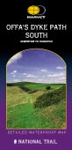
Scale 1:40,000; 2.5cm to 1km; 2� inches to 1 mile
| |
|
Offa's Dyke Path South map - Knighton to Chepstow
|
click to enlarge
|
1:40,000; 2.5cm to 1km;
Dimensions: 248 mm x 132 mm
|

|
|
|
|
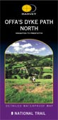
Offa's Dyke Path North map - Prestatyn to Knighton
|
click to enlarge
|
1:40,000; 2.5cm to 1km;
Dimensions: 248 mm x 132 mm
|
|
|
|
|
Ordnance Survey Landranger Series

|
|
Scale 1:50,000; 2cm to 1km; 1� inches to 1 mile
If one of your enjoyments of savouring the countryside throughout your walk is to examine the broader picture and to line up the hill tops in the surrounding area, then these maps are for you
|
| |
|
These maps are available in three editions:
Paper - they fold well, and are backed with a reasonably durable laminated cover. They will remain intact, depending on how much wind and rain you have encountered!
Wilderness - laminated, tear resistant and waterproof they are designed for use in wind and rain and should arrive home with you as a permanent souvenir.
Lam-Fold - extra strong lamination with a 'china-graph' write-on, wipe-off surface they are also tear resistant and waterproof. They are however, a little bulkier than the 'wilderness' version.
|
| |
|
|
| |
|
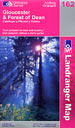
Map 162: Gloucester & Forest of Dean
|
click to enlarge
|
1:50,000; 2cm to 1km; 1.25 inches to 1 mile
Dimensions: 225 mm x 135 mm
|

|
|
|
|
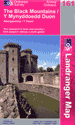
Map 161: Abergavenny & the Black Mountains
|
click to enlarge
|
1:50,000; 2cm to 1km; 1.25 inches to 1 mile
Dimensions: 225 mm x 135 mm
|
|
|
|
|
|
Map 148: Presteigne & Hay-on-Wye area
|
click to enlarge
|
1:50,000; 2cm to 1km; 1.25 inches to 1 mile
Dimensions: 225 mm x 135 mm
|
|
|
|
|
|
Map 137: Ludlow, Wenlock Edge & area
|
click to enlarge
|
1:50,000; 2cm to 1km; 1.25 inches to 1 mile
Dimensions: 225 mm x 135 mm
|
|
|
|
|
|
Map 126: Shrewsbury & Oswestry
|
click to enlarge
|
1:50,000; 2cm to 1km; 1.25 inches to 1 mile
Dimensions: 225 mm x 135 mm
|
|
|
|
|
|
Map 117: Chester & Wrexham. Ellesmere Port
|
click to enlarge
|
1:50,000; 2cm to 1km; 1.25 inches to 1 mile
Dimensions: 225 mm x 135 mm
|
|
|
|
|
|
Map 116: Denbigh & Colwyn Bay
|
click to enlarge
|
1:50,000; 2cm to 1km; 1.25 inches to 1 mile
Dimensions: 225 mm x 135 mm
|
|
|
|
|
|
|
|
Ordnance Survey Explorer Maps
|
|
Scale 1:25,000; 4cm to 1km; 2� inches to 1 mile
This scale provides detail for the really committed navigator and map enthusiast. Studying the county down to its every wall and ditch gives real confidence in route finding and satisfaction in "reading" the landscape. To follow the route at 1:25,000 you will need Explorer maps OL14, OL13, 201, 216, 240, 256 and 265.
These maps are available in three editions:
Paper - they fold well, and are backed with a reasonably durable laminated cover. They will remain intact, depending on how much wind and rain you have encountered!
Wilderness - laminated, tear resistant and waterproof they are designed for use in wind and rain and should arrive home with you as a permanent souvenir.
Lam-Fold - extra strong lamination with a 'china-graph' write-on, wipe-off surface they are also tear resistant and waterproof. They are however, a little bulkier than the 'wilderness' version.
|
| |
|
Offas-Dyke Suggestions
|
|
|
The Wilderness Edition maps are a good compromise between the paper maps that are likely to self-destruct in the wind, rain, sleet & snow and the
heavier duty Lam-Fold Editions.
|
|
|
| |
|
Map OL14: Wye Valley & Forest of Dean
|
click to enlarge
|
1:25,000; 2.5 inches to 1 mile; 4cm to 1km
Dimensions: 225 mm x 135 mm
|
|
|
|
|
|
Map OL13: Breacon Beacons National Park
|
click to enlarge
|
1:25,000; 2.5 inches to 1 mile; 4cm to 1km
Dimensions: 225 mm x 135 mm
|
|
|
|
|
|
Map 201: Knighton & Presteigne
|
click to enlarge
|
1:25,000; 2.5 inches to 1 mile; 4cm to 1km
Dimensions: 225 mm x 135 mm
|
|
|
|
|
|
Map 216: Welshpool & Montgomery
|
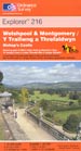
click to enlarge
|
1:25,000; 2.5 inches to 1 mile; 4cm to 1km
Dimensions: 225 mm x 135 mm
|
|
|
|
|
|
Map 240: Oswestry
|
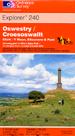
click to enlarge
|
1:25,000; 2.5 inches to 1 mile; 4cm to 1km
Dimensions: 225 mm x 135 mm
|
|
|
|
|
|
Map 256: Wrexham & Llangollen
|
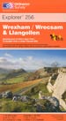
click to enlarge
|
1:25,000; 2.5 inches to 1 mile; 4cm to 1km
Dimensions: 225 mm x 135 mm
|
|
|
|
|
|
Map 265: Clwydian Range
|
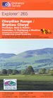
click to enlarge
|
1:25,000; 2.5 inches to 1 mile; 4cm to 1km
Dimensions: 225 mm x 135 mm
|
|
|
|
|
|
Offas-Dyke Suggestions
|
|
|
Your choice of maps is dependant upon your choice of scale and pocket! If you can justify the small extra cost, our recommendation is to go for the seven Explorer maps - and better still, if you can afford it, the Wilderness Editions.
|
|
|
| |
| |